Professional Land Surveying Services
Precision surveying solutions for residential, commercial, and industrial developments across Zimbabwe
Our Services Our Technology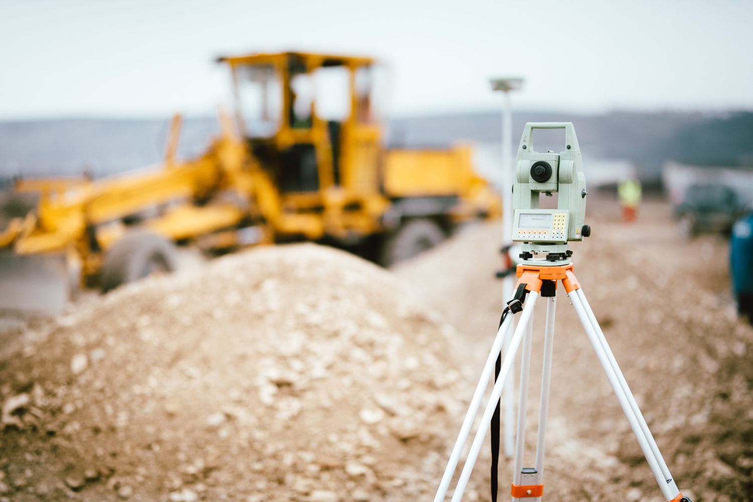
Precision surveying solutions for residential, commercial, and industrial developments across Zimbabwe
Our Services Our Technology
Damofalls Investments offers professional land surveying services to support all phases of land development. Our certified surveyors provide accurate data essential for planning, design, and construction.
With over 15 years of experience in Zimbabwe's diverse terrain, we deliver reliable surveys that meet all regulatory requirements and international standards.
Projects Surveyed
Accuracy Guarantee
Detailed mapping of natural and man-made features including contours, elevations, and existing structures.
Accurate determination and marking of property lines for legal and development purposes.
Official surveys for land registration and property ownership documentation.
Precise marking of proposed structures, roads, and utilities for construction teams.
Underwater mapping for water bodies, dams, and riverine developments.
Calculations of cut and fill volumes for earthworks and mining operations.
High-precision GPS/GNSS receivers for accurate geodetic positioning
Accuracy: 5mm ± 1ppm RTK
Robotic total stations for precise angle and distance measurements
Accuracy: 1" angular, 2mm + 2ppm distance
Terrestrial laser scanners for high-density point cloud data
Range: 350m @ 90% reflectivity
Aerial photogrammetry for large-area topographic mapping
Resolution: 1cm GSD
Understanding client requirements and project specifications
Gathering existing records, control points, and planning fieldwork
Data collection using appropriate equipment and techniques
Analysis, adjustments, and preparation of deliverables
Verification and validation of survey results
Providing final survey products to client
CAD drawings showing all surveyed features and measurements
Detailed documentation of methods, findings, and recommendations
Scaled maps with contours, features, and elevation data
GIS-compatible files (DWG, DXF, SHP, LandXML)
Contact our team of certified surveyors for accurate, reliable surveying services.
Request a Quote Call Our Surveyors